


Clackamas County, Oregon | |
|---|---|
 Seal  Logo | |
 Location within the U.S. state of Oregon | |
| Coordinates: 45°11′N 122°13′W / 45.19°N 122.21°W / 45.19; -122.21 | |
| Country |  United States United States |
| State |  Oregon Oregon |
| Founded | July 5, 1843 |
| Named after | Clackamas people |
| Seat | Oregon City |
| Largest city | Lake Oswego |
| Area | |
• Total | 1,883 sq mi (4,880 km2) |
| • Land | 1,870 sq mi (4,800 km2) |
| • Water | 13 sq mi (34 km2) 0.7% |
| Population (2020) | |
• Total | 421,401 |
• Estimate (2025) | 426,280  |
| • Density | 225/sq mi (87.0/km2) |
| Time zone | UTC−8 (Pacific) |
| • Summer (DST) | UTC−7 (PDT) |
| Congressional districts | 2nd, 3rd, 5th, 6th |
| Website | www |
.jpg&mode=clean)
_-_056.jpg&mode=clean)


Clackamas County ( ⓘ CLAK-ə-məss) is one of the 36 counties in the U.S. state of Oregon. As of the 2020 census, the population was 421,401, making it Oregon's third-most populous county.[1] Its county seat is Oregon City.[2] The county was named after the native people living in the area at the time of the coming of Europeans, the Clackamas people, who are part of the Chinookan peoples.
Clackamas County is part of the Portland-Vancouver-Hillsboro, OR-WA Metropolitan Statistical Area. It is in the Willamette Valley.
History
[edit]Originally named Clackamas District, it was one of the four original Oregon districts created by Oregon's Provisional Legislature on July 5, 1843, along with Twality (later Washington), Champooick (later Marion), and Yamhill. At the time of its creation, Clackamas County covered portions of modern Oregon, Washington, Idaho, Montana, and British Columbia.[3] The Columbia River became the northern boundary of the county in 1844. Soon after, John McLoughlin staked a land claim in Oregon City and built a house that in 2003 became a unit of the Fort Vancouver National Historic Site. The four districts were ultimately redesignated as counties in 1845.
Most of the indigenous people of the Wil-lamet Valley were forcibly removed in February 1859, to the reservation of the Confederated Tribes of Grand Ronde. Most were moved without treaty or compensation for lost lands or resources. Some 22 tribes were moved during the cold winter. It is estimated that 30% did not survive the first year. The tribes eventually prospered, but outside of Clackamas County. They also never received any revenue or compensation from the logging of their homeland forests.
In addition, the Tribes of the Cascades Mountains were isolated to a Reservation after the signing of a treaty in 1859. Confederated Tribes of Warmsprings was established and remains a strong and vital player in actions that concern the Federal forests of the Cascades Range.
Oregon City was also the site of the only federal court west of the Rockies in 1849, when San Francisco, California, was platted. The plat was filed in 1850 in the first plat book of the first office of records on the West Coast and is still in Oregon City.
Around 1900, the spa and resort at Wilthoit Springs was a popular tourist destination.[4] In 1902, the Willamette Meteorite was removed from a field near present-day West Linn.
Geography
[edit]
According to the United States Census Bureau, the county has a total area of 1,883 square miles (4,880 km2), of which 1,870 square miles (4,800 km2) is land and 12 square miles (31 km2) (0.7%) is water.[5]
Major highways
[edit]


- Multnomah County - north
- Hood River County - northeast
- Wasco County - east
- Marion County - south
- Yamhill County - west
- Washington County - northwest
The county includes parts of two national forests: Mount Hood National Forest and Willamette National Forest.
Demographics
[edit]| Census | Pop. | Note | %± |
|---|---|---|---|
| 1850 | 1,859 | — | |
| 1860 | 3,466 | 86.4% | |
| 1870 | 5,993 | 72.9% | |
| 1880 | 9,260 | 54.5% | |
| 1890 | 15,233 | 64.5% | |
| 1900 | 19,658 | 29.0% | |
| 1910 | 29,931 | 52.3% | |
| 1920 | 37,698 | 25.9% | |
| 1930 | 46,205 | 22.6% | |
| 1940 | 57,130 | 23.6% | |
| 1950 | 86,716 | 51.8% | |
| 1960 | 113,038 | 30.4% | |
| 1970 | 166,088 | 46.9% | |
| 1980 | 241,919 | 45.7% | |
| 1990 | 278,850 | 15.3% | |
| 2000 | 338,391 | 21.4% | |
| 2010 | 375,992 | 11.1% | |
| 2020 | 421,401 | 12.1% | |
| 2025 (est.) | 426,280 | [6] | 1.2% |
| U.S. Decennial Census[7] 1790–1960[8] 1900–1990[9] 1990–2000[10] 2010–2020[1] | |||
2020 census
[edit]As of the 2020 census, the county had a population of 421,401. Of the residents, 21.5% were under the age of 18 and 19.2% were 65 years of age or older; the median age was 41.7 years. For every 100 females there were 96.9 males, and for every 100 females age 18 and over there were 94.7 males. 82.9% of residents lived in urban areas and 17.1% lived in rural areas.[11][12]
Detailed counts of the non-Hispanic or Latino racial and ethnic groups from 1980 through 2020 are shown below.
| Race / Ethnicity (NH = Non-Hispanic) | Pop 1980[13] | Pop 1990[14] | Pop 2000[15] | Pop 2010[16] | Pop 2020[17] | % 1980 | % 1990 | % 2000 | % 2010 | % 2020 |
|---|---|---|---|---|---|---|---|---|---|---|
| White alone (NH) | 233,221 | 263,965 | 301,548 | 317,648 | 325,361 | 96.40% | 94.66% | 89.11% | 84.48% | 77.21% |
| Black or African American alone (NH) | 757 | 1,107 | 2,056 | 2,761 | 4,336 | 0.31% | 0.40% | 0.61% | 0.73% | 1.03% |
| Native American or Alaska Native alone (NH) | 1,225 | 1,824 | 2,090 | 2,340 | 2,249 | 0.51% | 0.65% | 0.62% | 0.62% | 0.53% |
| Asian alone (NH) | 2,376 | 4,723 | 8,216 | 13,575 | 20,459 | 0.98% | 1.69% | 2.43% | 3.61% | 4.85% |
| Native Hawaiian or Pacific Islander alone (NH) | x [18] | x [19] | 521 | 815 | 1,056 | x | x | 0.15% | 0.22% | 0.25% |
| Other race alone (NH) | 716 | 102 | 317 | 438 | 2,158 | 0.30% | 0.04% | 0.09% | 0.12% | 0.51% |
| Mixed race or Multiracial (NH) | x [20] | x [21] | 6,899 | 9,277 | 25,440 | x | x | 2.04% | 2.47% | 6.04% |
| Hispanic or Latino (any race) | 3,624 | 7,129 | 16,744 | 29,138 | 40,342 | 1.50% | 2.56% | 4.95% | 7.75% | 9.57% |
| Total | 241,919 | 278,850 | 338,391 | 375,992 | 421,401 | 100.00% | 100.00% | 100.00% | 100.00% | 100.00% |
The racial makeup of the county was 79.5% White, 1.1% Black or African American, 0.8% American Indian and Alaska Native, 4.9% Asian, 0.3% Native Hawaiian and Pacific Islander, 3.8% from some other race, and 9.6% from two or more races. Hispanic or Latino residents of any race comprised 9.6% of the population.[22]
There were 160,503 households in the county, of which 30.6% had children under the age of 18 living with them and 23.1% had a female householder with no spouse or partner present. About 23.0% of all households were made up of individuals and 11.2% had someone living alone who was 65 years of age or older.[12]
There were 170,094 housing units, of which 5.6% were vacant. Among occupied housing units, 69.7% were owner-occupied and 30.3% were renter-occupied. The homeowner vacancy rate was 1.1% and the rental vacancy rate was 5.5%.[12]
2010 census
[edit]As of the 2010 census, there were 375,992 people, 145,790 households, and 100,866 families in the county.[23] The population density was 201.0 inhabitants per square mile (77.6/km2). There were 156,945 housing units at an average density of 83.9 per square mile (32.4/km2).[24] The racial makeup of the county was 88.2% white, 3.7% Asian, 0.8% American Indian, 0.8% black or African American, 0.2% Pacific islander, 3.1% from other races, and 3.2% from two or more races. Those of Hispanic or Latino origin made up 7.7% of the population.[23] In terms of ancestry, 24.9% were German, 14.5% were English, 13.3% were Irish, 5.0% were Norwegian, and 4.9% were American.[25]
Of the 145,790 households, 32.8% had children under the age of 18 living with them, 54.8% were married couples living together, 9.8% had a female householder with no husband present, 30.8% were non-families, and 24.1% of all households were made up of individuals. The average household size was 2.56 and the average family size was 3.04. The median age was 40.6 years.[23]
The median income for a household in the county was $62,007 and the median income for a family was $74,905. Males had a median income of $53,488 versus $39,796 for females. The per capita income for the county was $31,785. About 6.1% of families and 9.0% of the population were below the poverty line, including 11.2% of those under age 18 and 6.2% of those age 65 or over.[26]
2000 census
[edit]As of the 2000 census, there were 338,391 people, 128,201 households, and 91,663 families in the county. The population density was 181 people per square mile (70 people/km2). There were 136,954 housing units at an average density of 73 units per square mile (28/km2). The racial makeup of the county was 91.27% White, 2.45% Asian, 0.71% Native American, 0.66% Black or African American, 0.17% Pacific Islander, 2.28% from other races, and 2.46% from two or more races. 4.95% of the population were Hispanic or Latino of any race. 20.7% were of German, 11.6% English, 9.1% Irish and 7.5% American ancestry.
There were 128,201 households, out of which 34.20% had children under the age of 18 living with them, 58.60% were married couples living together, 9.00% had a female householder with no husband present, and 28.50% were non-families. 22.00% of all households were made up of individuals, and 7.80% had someone living alone who was 65 years of age or older. The average household size was 2.62 and the average family size was 3.07.
The county population contained 26.20% under the age of 18, 8.00% from 18 to 24, 28.70% from 25 to 44, 26.00% from 45 to 64, and 11.10% who were 65 years of age or older. The median age was 38 years. For every 100 females, there were 97.50 males. For every 100 females age 18 and over, there were 94.90 males.
The median income for a household in the county was $52,080, and the median income for a family was $60,791. Males had a median income of $43,462 versus $30,891 for females. The per capita income for the county was $25,973. About 4.60% of families and 6.60% of the population were below the poverty line, including 7.60% of those under age 18 and 5.10% of those age 65 or over.
Communities
[edit]

Several of the county's cities extend into other counties. Lake Oswego and Milwaukie include areas in Multnomah County. Lake Oswego, Rivergrove and Wilsonville include areas in Washington County. The cities of Portland and Tualatin extend into Clackamas County from Multnomah and Washington counties respectively.
In Clackamas County, hamlets and villages are models of local land use governance for unincorporated areas. The four hamlets in Clackamas County are Beavercreek, Molalla Prairie, Mulino, and Stafford. The county's only village is the Villages at Mount Hood.
Cities
[edit]- Barlow
- Canby
- Damascus (former)
- Estacada
- Gladstone
- Happy Valley
- Johnson City
- Lake Oswego
- Milwaukie
- Molalla
- Oregon City (county seat)
- Portland
- Rivergrove
- Sandy
- Tualatin
- West Linn
- Wilsonville
Census-designated places
[edit]Hamlets
[edit]- Beavercreek
- Molalla Prairie (former)
- Mulino
- Stafford
Locales, etc.
[edit]Unincorporated communities
[edit]- Barton
- Boring
- Brightwood
- Bull Run
- Carus
- Carver
- Cherryville
- Clackamas
- Clarkes
- Colton
- Cottrell
- Eagle Creek
- Faubion
- Government Camp
- Jean
- Jennings Lodge
- Kelso
- Ladd Hill
- Lakewood
- Liberal
- Logan
- Lone Elder
- Macksburg
- Marmot
- Marquam
- Milwaukie Heights
- Mountain Air Park
- Needy
- New Era
- Oak Grove
- Oatfield
- Redland
- Rhododendron
- Ripplebrook
- Riverside
- Shadowood
- Springwater
- Stafford
- Welches
- Wemme
- Wildwood
- Yoder
- Zigzag
Former unincorporated communities
[edit]- Bissell – named for W. S. Bissell, U.S. Postmaster General from 1893 to 1895.[27] Bissell had its own post office from at least 1899 to 1923.
Economy
[edit]Since the county's creation, agriculture, timber, manufacturing, and commerce have been the principal economic activities. Mount Hood, the only year-round ski resort in the United States and the site of Timberline Lodge, is a major attraction for recreation and tourism, offering outdoor recreation activities from skiing and rafting to fishing and camping.
Infrastructure
[edit]The county supports the Library Information Network of Clackamas County. The urban areas of the county are also served by Metro.
Education
[edit]School districts include:[34]
- Canby School District 86
- Centennial School District 28J
- Colton School District 53
- Estacada School District 108
- Gladstone School District 115
- Gresham-Barlow School District 1J
- Lake Oswego School District 7J
- Molalla River School District 35
- Newberg School District 29J
- North Clackamas School District 12
- Oregon City School District 62
- Portland School District 1J
- Riverdale School District 51J
- Oregon Trail School District 46
- Sherwood School District 88J
- Silver Falls School District 4J
- Tigard-Tualatin School District 23J
- West Linn-Wilsonville School District 3J
Notable people
[edit]- Bob Amsberry (1928–1957), original member of The Mickey Mouse Club[35]
- Rebecca Anderson (born 1991), beauty pageant titleholder[36]
- Debby Applegate (born 1968), biographer and historian[37]
- Jay Baller (born 1960), baseball player
- Howard C. Belton (1893–1988), Oregon State Treasurer
- William H. Boring (1841–1932), Union soldier; founder of Boring
- Nan Britton (1896–1991), secretary and mistress of President Warren G. Harding[38]
- George Bruns (1914–1984), Walt Disney Pictures film composer[39]
- Ed Coleman (1901–1964), baseball player
- Ralph Coleman (1895–1990), baseball coach[40]
- Ryan Crouser (born 1992), shot putter, discus thrower, Olympic Gold Medalist[41]
- Carson Ellis (born 1975), artist and illustrator
- Philip Foster (1805–1884), pioneer
- Alma Francis (1890–1968), stage actress and singer[42]
- Tom Gorman (born 1957), baseball pitcher[43]
- Tonya Harding (born 1970), Olympic figure skater[44]
- Joni Harms (born 1959), musician
- Bill Johnson (1960–2016), Olympic skier[45]
- Edwin Markham (1852–1940), Poet Laureate of Oregon
- Colin Meloy (born 1974), musician
- Charis Michelsen (born 1974), actress, model, and makeup artist
- Bill Morgan (1910–1985), football player
- Ben Musa (1905–1974), Oregon state legislator
- Alan Olsen (born 1948), Oregon State Senator
- Ralph Patt (1929–2010),[46] jazz-guitarist who invented major-thirds tuning;[47] geological expert on groundwater contamination from the Hanford Site.[48][49]
- Burt Rutan (born 1943), aerospace engineer
- Kurt Schrader (born 1951), U.S. Representative from Oregon
- Martha Schrader (born 1953), Oregon State Senator
- Chael Sonnen (born 1977), wrestler
- Brenda Strong (born 1960), film and television actress[50]
- Maria Thayer (born 1975), actress and comedian[51]
- Mark Thorson (born 1983), football player[52]
- Aaron E. Waite (1813–1898), Oregon Supreme Court justice
- Brian Wilbur (born 1986), Granada Lions quarterback
See also
[edit]- National Register of Historic Places listings in Clackamas County, Oregon
- Wilthoit Springs, county park and historic site[4]
Notes
[edit]References
[edit]- 1 2 "State & County QuickFacts". United States Census Bureau. Retrieved April 21, 2023.
- ↑ "Find a County". National Association of Counties. Archived from the original on May 31, 2011. Retrieved June 7, 2011.
- ↑ "Relation: Clackamas County (1843-1844) [1843 – 1844] (2786933)". OpenHistoricalMap. November 4, 2024. Retrieved June 4, 2025.
- 1 2 "Wilhoit Springs Park | Clackamas County". www.clackamas.us. Retrieved January 25, 2024.
- ↑ "2010 Census Gazetteer Files". United States Census Bureau. August 22, 2012. Retrieved February 25, 2015.
- ↑ "County Population Totals and Components of Change: 2020-2025". United States Census Bureau. Retrieved April 12, 2026.
- ↑ "U.S. Decennial Census". United States Census Bureau. Retrieved February 25, 2015.
- ↑ "Historical Census Browser". University of Virginia Library. Archived from the original on August 11, 2012. Retrieved February 25, 2015.
- ↑ Forstall, Richard L., ed. (March 27, 1995). "Population of Counties by Decennial Census: 1900 to 1990". United States Census Bureau. Retrieved February 25, 2015.
- ↑ "Census 2000 PHC-T-4. Ranking Tables for Counties: 1990 and 2000" (PDF). United States Census Bureau. April 2, 2001. Archived from the original (PDF) on February 26, 2015. Retrieved February 25, 2015.
- ↑ "2020 Decennial Census Demographic and Housing Characteristics (DHC)". United States Census Bureau. 2023. Retrieved 10 December 2025.
- 1 2 3 "2020 Decennial Census Demographic Profile (DP1)". United States Census Bureau. 2021. Retrieved 10 December 2025.
- ↑ "1980 Census of Population - General Population Characteristics - Oregon - Table 58 - Persons by Race and Table 59 - Total Persons and Spanish Origin Persons by Type of Spanish Origin and Race (p. 39/24-39/32)" (PDF). United States Census Bureau.
- ↑ "1990 Census of Population - General Population Characteristics - Oregon - Table 5 - Race and Hispanic Origin" (PDF). United States Census Bureau. p. 9-30.
- ↑ "P004: Hispanic or Latino, and Not Hispanic or Latino by Race – 2000: DEC Summary File 1 – Clackamas County, Oregon". United States Census Bureau.
- ↑ "P2: Hispanic or Latino, and Not Hispanic or Latino by Race – 2010: DEC Redistricting Data (PL 94-171) – Clackamas County, Oregon". United States Census Bureau.
- ↑ "P2: Hispanic or Latino, and Not Hispanic or Latino by Race – 2020: DEC Redistricting Data (PL 94-171) – Clackamas County, Oregon". United States Census Bureau.
- ↑ included in the Asian category in the 1980 Census
- ↑ included in the Asian category in the 1990 Census
- ↑ not an option in the 1980 Census
- ↑ not an option in the 1990 Census
- ↑ "2020 Decennial Census Redistricting Data (Public Law 94-171)". United States Census Bureau. 2021. Retrieved 10 December 2025.
- 1 2 3 "Profile of General Population and Housing Characteristics: 2010 Demographic Profile Data". United States Census Bureau. Retrieved February 23, 2016.
{{cite web}}: CS1 maint: deprecated archival service (link) - ↑ "Population, Housing Units, Area, and Density: 2010 - County". United States Census Bureau. Retrieved February 23, 2016.
{{cite web}}: CS1 maint: deprecated archival service (link) - ↑ "Selected Social Characteristics in the US – 2006-2010 American Community Survey 5-Year Estimates". United States Census Bureau. Retrieved February 23, 2016.
{{cite web}}: CS1 maint: deprecated archival service (link) - ↑ "Selected Economic Characteristics – 2006-2010 American Community Survey 5-Year Estimates". United States Census Bureau. Retrieved February 23, 2016.
{{cite web}}: CS1 maint: deprecated archival service (link) - ↑ McArthur, Lewis A. (December 1925). "Oregon Geographic Names". The Quarterly of the Oregon Historical Society. 26 (4): 342. JSTOR 20610329.
- ↑ United States Official Postal Guide. United States Post Office. 1923. p. 649.
- ↑ United States Official Postal Guide. United States Post Office. 1899. p. 496.
- ↑ Doyle, Bryce (May 19, 2025). "Clackamas County picks former Damascus mayor to fill board seat after Fireside resignation". OPB. Retrieved May 19, 2025.
- ↑ Dole, Bryce (March 7, 2025). "Melissa Fireside resigns from Clackamas County Commission days after felony indictment". Oregon Public Broadcasting. Retrieved March 12, 2025.
- 1 2 "Elected Officials: Clackamas County". Clackamas County, Oregon. Retrieved January 7, 2025.
- ↑ Leip, David. "Atlas of US Presidential Elections". uselectionatlas.org. Retrieved April 4, 2018.
- ↑ Geography Division (December 18, 2020). 2020 Census - School District Reference Map: Clackamas County, OR (PDF) (Map). Suitland, Maryland: U.S. Census Bureau. Retrieved June 23, 2026. - Text list
- ↑ "Mickey Mouse Club Cast: Bob Amsberry". Original Mickey Mouse Club. Archived from the original on April 17, 2022. Retrieved April 9, 2016.
- ↑ Spitaleri, Ellen (June 24, 2013). "OCHS graduate sisters compete for state pageant crown". Portland Tribune. Portland, OR: Pamplin Media Group. Archived from the original on July 1, 2013. Retrieved August 16, 2015.
- ↑ Pulitzer-prize winning author has Eastern Oregon ties, East Oregonian, May 9, 2007.(subscription required)
- ↑ Green, Aimee (August 16, 2015). "Woman who loved Harding finally vindicated". The Oregonian. Portland, Oregon. p. A2. Archived from the original on March 26, 2018.
- ↑ "George Bruns". Moviefone.
{{cite web}}: CS1 maint: deprecated archival service (link) - ↑ "Oregon State Baseball". Oregon State University. Archived from the original on June 1, 2010.
- ↑ Mesh, Aaron (August 23, 2016). "Here's How Far Oregon Olympian Ryan Crouser Threw a Shot Put". Willamette Week.
{{cite web}}: CS1 maint: deprecated archival service (link) - ↑ "Obituary: Alma Francis Fields". The Oregonian. Portland, Oregon. August 23, 1968. p. 1.
- ↑ Simon, Mark (July 2, 2010). "Remembering the wackiest game ever". ESPN.com. Retrieved October 1, 2018.
- ↑ Brennan, Christine (January 20, 1994). "Rival Skater's Ex-Husband Charged in Attack". The Washington Post. Archived from the original on January 2, 2018. Retrieved August 14, 2018.
- ↑ Miller, Peter (November 1984). "Being Bill". Ski. 49: 52. ISSN 0037-6159.
- ↑ "Ralph Oliver Patt: Canby, Oregon". Death-Record. Retrieved August 15, 2012.
{{cite web}}: CS1 maint: deprecated archival service (link) - ↑ Griewank (2010, p. 1): Griewank, Andreas (January 1, 2010), Tuning guitars and reading music in major thirds, Matheon preprints, vol. 695, Rosestr. 3a, 12524 Berlin, Germany: DFG research center "MATHEON, Mathematics for key technologies" Berlin, MSC-Classification 97M80 Arts. Music. Language. Architecture
{{citation}}: CS1 maint: location (link) (Postscript file and PDF file) - ↑ Associated Press (August 7, 1991). "DOE (Department of Energy) says report on accidents at Hanford to be released soon". Lewiston Morning Tribune. Yakima. Retrieved August 17, 2012.Geronios, Nicholas K. (August 7, 1991). "DOE accused of concealing report: Document may detail 125 Hanford accidents". The Spokesman-Review (Spokane, WA). Retrieved August 17, 2012.
- ↑ Dorn Steele, Karen (July 13, 1997). "Cracks in Hanford's clean bill of health: Congressional watchdogs want to make sure nuclear facility plugs leaks". The Spokesman-Review (Spokane, WA). Archived from the original on June 11, 2014.
- ↑ Baker, Jeff (April 30, 2014). "17 actors you (maybe) didn't know were from Oregon". The Oregonian. Portland, Oregon. Archived from the original on February 23, 2015.
- ↑ Turnquist, Kristi (February 11, 2016). "TV's Maria Thayer: From a bee farm in Boring to the new sitcom, 'Those Who Can't'". The Oregonian. Retrieved September 25, 2016.
- ↑
- H.O. Lang (ed.), History of the Willamette Valley: Being a Description of the Valley and its Resources, with an Account of its Discovery and Settlement by White Men, and its Subsequent History; Together with Personal Reminiscences of its Early Pioneers. Portland: Himes and Lang, 1885.
- Vera Lynch, Free Land for Free Men: A Story of Clackamas County. Oregon City, OR: Clackamas County Family History Society, 2000.
- Portrait and Biographical Record of the Willamette Valley, Oregon, Containing Original Sketches of Many Well Known Citizens of the Past and Present. Chicago: Chapman Publishing Co., 1903.
- Turnbull, George S. (1939). . . Binfords & Mort.
External links
[edit]- Clackamas County, Oregon
- Clackamas County hamlets and villages
- Clackamas County Considering Hamlets and Villages Archived September 26, 2007, at the Wayback Machine, a September 2005 article from Oregon Public Broadcasting
| ||||||||||||||||


Municipalities and communities of Clackamas County, Oregon, United States | ||
|---|---|---|
| Cities | 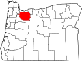 | |
| Hamlets | ||
| CDPs | ||
| Other communities |
| |
| Indian reservation | ||
| Footnotes | ‡This populated place also has portions in an adjacent county or counties | |
Salem (capital) | |||||||||
| Topics | |||||||||
| Society | |||||||||
| Regions |
| ||||||||
| Metro areas | |||||||||
| Largest cities (pop. >50,000) | |||||||||
| Counties | |||||||||

| International | |
|---|---|
| National | |
| Geographic | |
| Other | |
