


Jefferson County, Illinois | |
|---|---|
 Jefferson County Courthouse in Mount Vernon | |
 Location within the U.S. state of Illinois | |
| Coordinates: 38°18′N 88°55′W / 38.3°N 88.92°W / 38.3; -88.92 | |
| Country |  United States United States |
| State |  Illinois Illinois |
| Founded | 1819 |
| Named after | Thomas Jefferson |
| Seat | Mount Vernon |
| Largest city | Mount Vernon |
| Area | |
• Total | 584 sq mi (1,510 km2) |
| • Land | 571 sq mi (1,480 km2) |
| • Water | 13 sq mi (34 km2) 2.2% |
| Population (2020) | |
• Total | 37,113 |
• Estimate (2025) | 36,147  |
| • Density | 65.0/sq mi (25.1/km2) |
| Time zone | UTC−6 (Central) |
| • Summer (DST) | UTC−5 (CDT) |
| Congressional district | 12th |
| Website | jeffersoncounty |
Jefferson County is a county located in the southern part of the U.S. state of Illinois. According to the 2020 census, it has a population of 37,113.[1] The county seat is Mount Vernon.[2] Jefferson County also constitutes the Mount Vernon micropolitan area, anchored by the city of Mount Vernon. It is located in the southern portion known locally as "Little Egypt". The western border of the county adjoins the Greater St. Louis consolidated metropolitan statistical area, the Metro-East region, and the St. Louis commuter region and market and television viewing area.
History
[edit]The first settler in Jefferson County is believed to have been Andrew Moore. In 1810, he settled near the southeast corner of the county, near where the Goshen Road emerges from the forest of Hamilton County into what is now known as Moore's Prairie. Moore arrived from the Goshen Settlement, near Edwardsville. His migration was therefore retrograde, from the west toward the interior of the State.
In 1814, Andrew Moore departed with his eight-year-old son for Jordan's settlement, a journey from which he never returned. A skull that was believed to have been Moore's was found several years later about two miles from his cabin. Jordan's Settlement, also called Jordan's Fort, was southeast of modern Thompsonville, Illinois, about twenty miles south of Moore's cabin. This episode occurred during the War of 1812 when many of the Indian tribes were allied with the British.
In 1816, Carter Wilkey, Daniel Crenshaw and Robert Cook settled in Moore's Prairie. Daniel Crenshaw moved into Moore's cabin. This settlement is believed to be the first permanent settlement in the county.
Jefferson County was organized in 1819, out of parts of White, Edwards and Franklin Counties. It was named in honor of Thomas Jefferson, principal draftsman of the Northwest Ordinance, among other things.[3] The baseline along the northern border of the County crosses the Third Principal Meridian at the northwest corner of the county.
 Jefferson County between the time of its creation and 1821
 Jefferson County between 1821 and 1823
 Jefferson County in 1823, reduced to its current size


Geography
[edit]According to the U.S. Census Bureau, the county has a total area of 584 square miles (1,510 km2), of which 571 square miles (1,480 km2) is land and 13 square miles (34 km2) (2.2%) is water.[4]
Climate and weather
[edit]| Mount Vernon, Illinois | ||||||||||||||||||||||||||||||||||||||||||||||||||||||||||||
|---|---|---|---|---|---|---|---|---|---|---|---|---|---|---|---|---|---|---|---|---|---|---|---|---|---|---|---|---|---|---|---|---|---|---|---|---|---|---|---|---|---|---|---|---|---|---|---|---|---|---|---|---|---|---|---|---|---|---|---|---|
| Climate chart (explanation) | ||||||||||||||||||||||||||||||||||||||||||||||||||||||||||||
| ||||||||||||||||||||||||||||||||||||||||||||||||||||||||||||
| ||||||||||||||||||||||||||||||||||||||||||||||||||||||||||||
In recent years, average temperatures in the county seat of Mount Vernon have ranged from a low of 19 °F (−7 °C) in January to a high of 88 °F (31 °C) in July, although a record low of −21 °F (−29 °C) was recorded in January 1994 and a record high of 114 °F (46 °C) was recorded in July 1936. Average monthly precipitation ranged from 2.45 inches (62 mm) in January to 4.58 inches (116 mm) in May.[5]
Major highways
[edit]


Transit
[edit]- Marion County – north
- Wayne County – northeast
- Hamilton County – southeast
- Franklin County – south
- Perry County – southwest
- Washington County – west
Demographics
[edit]| Census | Pop. | Note | %± |
|---|---|---|---|
| 1820 | 691 | — | |
| 1830 | 2,555 | 269.8% | |
| 1840 | 5,762 | 125.5% | |
| 1850 | 8,109 | 40.7% | |
| 1860 | 12,965 | 59.9% | |
| 1870 | 17,864 | 37.8% | |
| 1880 | 20,686 | 15.8% | |
| 1890 | 22,590 | 9.2% | |
| 1900 | 28,133 | 24.5% | |
| 1910 | 29,111 | 3.5% | |
| 1920 | 28,480 | −2.2% | |
| 1930 | 31,034 | 9.0% | |
| 1940 | 34,375 | 10.8% | |
| 1950 | 35,892 | 4.4% | |
| 1960 | 32,315 | −10.0% | |
| 1970 | 31,446 | −2.7% | |
| 1980 | 36,552 | 16.2% | |
| 1990 | 37,020 | 1.3% | |
| 2000 | 40,045 | 8.2% | |
| 2010 | 38,827 | −3.0% | |
| 2020 | 37,113[6] | Formatting error: invalid input when rounding% | |
| 2025 (est.) | 36,147 | [7] | Expression error: Unrecognized punctuation character "". |
| U.S. Decennial Census[8] 1790–1960[9] 1900–1990[10] 1990–2000[11] 2010–2013[1] | |||

2020 census
[edit]As of the 2020 census, the county had a population of 37,113, a median age of 42.2 years, 22.3% of residents under the age of 18, 20.2% of residents 65 years of age or older, 103.2 males for every 100 females, and 103.6 males for every 100 females age 18 and over.[12]
The racial makeup of the county was 84.7% White, 7.7% Black or African American, 0.2% American Indian and Alaska Native, 1.0% Asian, <0.1% Native Hawaiian and Pacific Islander, 0.9% from some other race, and 5.5% from two or more races. Hispanic or Latino residents of any race comprised 2.4% of the population.[13]
41.2% of residents lived in urban areas, while 58.8% lived in rural areas.[14]
There were 14,945 households in the county, of which 28.5% had children under the age of 18 living in them. Of all households, 46.7% were married-couple households, 19.6% were households with a male householder and no spouse or partner present, and 26.8% were households with a female householder and no spouse or partner present. About 30.7% of all households were made up of individuals and 14.0% had someone living alone who was 65 years of age or older.[12]
There were 16,632 housing units, of which 10.1% were vacant. Among occupied housing units, 73.1% were owner-occupied and 26.9% were renter-occupied. The homeowner vacancy rate was 2.4% and the rental vacancy rate was 10.3%.[12]
Racial and ethnic composition
[edit]| Race / Ethnicity (NH = Non-Hispanic) | Pop 1980[15] | Pop 1990[16] | Pop 2000[17] | Pop 2010[18] | Pop 2020[19] | % 1980 | % 1990 | % 2000 | % 2010 | % 2020 |
|---|---|---|---|---|---|---|---|---|---|---|
| White alone (NH) | 34,676 | 34,756 | 35,709 | 33,919 | 31,182 | 94.87% | 93.88% | 89.17% | 87.36% | 84.02% |
| Black or African American alone (NH) | 1,588 | 1,917 | 3,093 | 3,194 | 2,783 | 4.34% | 5.18% | 7.72% | 8.23% | 7.50% |
| Native American or Alaska Native alone (NH) | 31 | 52 | 77 | 69 | 77 | 0.08% | 0.14% | 0.19% | 0.18% | 0.21% |
| Asian alone (NH) | 66 | 126 | 188 | 246 | 352 | 0.18% | 0.34% | 0.47% | 0.63% | 0.95% |
| Native Hawaiian or Pacific Islander alone (NH) | x [20] | x [21] | 2 | 7 | 7 | x | x | 0.00% | 0.02% | 0.02% |
| Other race alone (NH) | 11 | 12 | 28 | 44 | 68 | 0.03% | 0.03% | 0.07% | 0.11% | 0.18% |
| Mixed race or Multiracial (NH) | x [22] | x [23] | 417 | 549 | 1,745 | x | x | 1.04% | 1.41% | 4.70% |
| Hispanic or Latino (any race) | 180 | 157 | 531 | 799 | 899 | 0.49% | 0.42% | 1.33% | 2.06% | 2.42% |
| Total | 36,552 | 37,020 | 40,045 | 38,827 | 37,113 | 100.00% | 100.00% | 100.00% | 100.00% | 100.00% |
2010 census
[edit]As of the 2010 United States census, there were 38,827 people, 15,365 households, and 10,140 families residing in the county.[24] The population density was 68.0 inhabitants per square mile (26.3/km2). There were 16,954 housing units at an average density of 29.7 per square mile (11.5/km2).[4] The racial makeup of the county was 88.4% white, 8.4% black or African American, 0.6% Asian, 0.2% American Indian, 0.8% from other races, and 1.6% from two or more races. Those of Hispanic or Latino origin made up 2.1% of the population.[24] In terms of ancestry, 24.3% were German, 15.8% were Irish, 13.6% were English, and 10.2% were American.[25]
Of the 15,365 households, 30.1% had children under the age of 18 living with them, 50.0% were married couples living together, 11.4% had a female householder with no husband present, 34.0% were non-families, and 29.1% of all households were made up of individuals. The average household size was 2.38 and the average family size was 2.92. The median age was 40.6 years.[24]
The median income for a household in the county was $41,161 and the median income for a family was $51,262. Males had a median income of $41,193 versus $29,645 for females. The per capita income for the county was $21,370. About 12.4% of families and 17.1% of the population were below the poverty line, including 24.8% of those under age 18 and 10.7% of those age 65 or over.[26]
Agencies
[edit]In 2015 the county police department announced that the words "" will be on police squad cars.
Communities
[edit]Cities
[edit]Villages
[edit]Census-designated place
[edit]Other unincorporated communities
[edit]Townships
[edit]Jefferson County is divided into sixteen townships:
Education
[edit]School districts include:[30]
K-12:
Secondary:
Elementary:
- Ashley Community Consolidated School District 15 – Can attend secondary school in Woodlawn
- Bethel School District 82
- Centralia School District 135
- Ewing Northern Community Consolidated District 115
- Farrington Community Consolidated School District 99 – Can attend secondary school at Bluford
- Field Community Consolidated School District 3
- Grand Prairie Community Consolidated School District 6 – Can attend secondary school in Woodlawn
- Kell Consolidated School District 2
- McClellan Community Consolidated School District 12
- Mount Vernon School District 80 – Can attend elementary school at Bluford and Woodlawn
- Opdyke-Belle Rive Community Consolidated School District 5 – Can attend secondary school at Bluford
- Spring Garden School District 178
- Rome Community Consolidated School District 2 – Can attend secondary school in Woodlawn
- Summersville School District 79
See also
[edit]References
[edit]- 1 2 "State & County QuickFacts". United States Census Bureau. Archived from the original on June 6, 2011. Retrieved July 6, 2014.
- ↑ "Find a County". National Association of Counties. Archived from the original on May 31, 2011. Retrieved June 7, 2011.
- ↑ Gannett, Henry (1905). The Origin of Certain Place Names in the United States. Govt. Print. Off. pp. 168.
- 1 2 "Population, Housing Units, Area, and Density: 2010 – County". United States Census Bureau. Retrieved July 11, 2015.
{{cite web}}: CS1 maint: deprecated archival service (link) - 1 2 "Monthly Averages for Mount Vernon, Illinois". The Weather Channel. Archived from the original on October 23, 2012. Retrieved January 27, 2011.
- ↑ Carolyn Stewart. "Census of Population and Housing - Publications - U.S. Census Bureau". census.gov. Retrieved April 22, 2026.
- ↑ "County Population Totals and Components of Change: 2020-2025". United States Census Bureau. Retrieved April 12, 2026.
- ↑ "U.S. Decennial Census". United States Census Bureau. Archived from the original on April 26, 2015. Retrieved July 6, 2014.
- ↑ "Historical Census Browser". University of Virginia Library. Archived from the original on August 11, 2012. Retrieved July 6, 2014.
- ↑ "Population of Counties by Decennial Census: 1900 to 1990". United States Census Bureau. Archived from the original on April 24, 2014. Retrieved July 6, 2014.
- ↑ "Census 2000 PHC-T-4. Ranking Tables for Counties: 1990 and 2000" (PDF). United States Census Bureau. Archived (PDF) from the original on March 27, 2010. Retrieved July 6, 2014.
- 1 2 3 "2020 Decennial Census Demographic Profile (DP1)". United States Census Bureau. 2021. Retrieved December 25, 2025.
- ↑ "2020 Decennial Census Redistricting Data (Public Law 94-171)". United States Census Bureau. 2021. Retrieved December 25, 2025.
- ↑ "2020 Decennial Census Demographic and Housing Characteristics (DHC)". United States Census Bureau. 2023. Retrieved December 25, 2025.
- ↑ "1980 Census of Population - General Population Characteristics - Illinois- Table 14 - Persons by Race and Table 16 (p. 18-28) - Total Persons and Spanish Origin Persons by Type of Spanish Origin and Race (p. 29-39)" (PDF). United States Census Bureau.
- ↑ "1990 Census of Population - General Population Characteristics - Illinois - Table 6 - Race and Hispanic Orogin" (PDF). United States Census Bureau.
- ↑ "P004: Hispanic or Latino, and Not Hispanic or Latino by Race – 2000: DEC Summary File 1 – Jefferson County, Illinois". United States Census Bureau.
- ↑ "P2: Hispanic or Latino, and Not Hispanic or Latino by Race – 2010: DEC Redistricting Data (PL 94-171) – Jefferson County, Illinois". United States Census Bureau.
- ↑ "P2: Hispanic or Latino, and Not Hispanic or Latino by Race – 2020: DEC Redistricting Data (PL 94-171) – Jefferson County, Illinois". United States Census Bureau.
- ↑ included in the Asian category in the 1980 Census
- ↑ included in the Asian category in the 1990 Census
- ↑ not an option in the 1980 Census
- ↑ not an option in the 1990 Census
- 1 2 3 "DP-1 Profile of General Population and Housing Characteristics: 2010 Demographic Profile Data". United States Census Bureau. Retrieved July 11, 2015.
{{cite web}}: CS1 maint: deprecated archival service (link) - ↑ "DP02 SELECTED SOCIAL CHARACTERISTICS IN THE UNITED STATES – 2006–2010 American Community Survey 5-Year Estimates". United States Census Bureau. Retrieved July 11, 2015.
{{cite web}}: CS1 maint: deprecated archival service (link) - ↑ "DP03 SELECTED ECONOMIC CHARACTERISTICS – 2006–2010 American Community Survey 5-Year Estimates". United States Census Bureau. Retrieved July 11, 2015.
{{cite web}}: CS1 maint: deprecated archival service (link) - ↑ "'In God We Trust' to be placed on Jefferson Co., IL squad cars" (Archive). KFVS. August 1, 2015. Retrieved on August 2, 2015.
- ↑ Cohn, Nate; ‘Demographic Shift: Southern Whites’ Loyalty to G.O.P. Nearing That of Blacks to Democrats’ Archived September 10, 2017, at the Wayback Machine, The New York Times, April 24, 2014
- ↑ Leip, David. "Dave Leip's Atlas of U.S. Presidential Elections". uselectionatlas.org. Archived from the original on March 23, 2018. Retrieved November 6, 2018.
- ↑ "2020 CENSUS – SCHOOL DISTRICT REFERENCE MAP: Jefferson County, IL" (PDF). U.S. Census Bureau. Archived (PDF) from the original on July 22, 2022. Retrieved July 22, 2022. – Text list
| ||||||||||||||||


Municipalities and communities of Jefferson County, Illinois, United States | ||
|---|---|---|
| Cities | 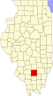 | |
| Villages | ||
| Townships | ||
| CDP | ||
| Other unincorporated communities | ||
| Footnotes | ‡This populated place also has portions in an adjacent county or counties | |
| Counties |  | |
|---|---|---|
| Major cities (25,000+) | ||
| Cities (5,000-25,000) | ||
| Communities (1,000-5,000) |
| |
| Transit systems | ||
| Amtrak stations |
| |
| Interstates | ||
| Airports | ||
| Colleges | ||
| Sports teams |
| |
| Topics |  | |
|---|---|---|
| Central city | ||
| Largest cities (over 50,000 in 2020) | ||
| Medium-sized cities (over 20,000 in 2020) | ||
| Largest towns and villages (over 10,000 in 2020) |
| |
| Missouri counties | ||
| Illinois counties | ||
| Subregions | ||
| Counties |  | |
|---|---|---|
| Mid-sized cities (25,000+) | ||
| Small cities (10,000-25,000) | ||
| Small cities (5,000-10,000) | ||
| Transit systems | ||
| Amtrak stations | ||
| Interstates | ||
| Airports/military bases |
| |
| Universities | ||
| Colleges | ||
| Sports teams based in Southern Illinois | ||
| International | |
|---|---|
| National | |
| Other | |
