MapTools Product -- Aerial Photo UTM Corner Rulers
Aerial Photo UTM Corner Rulers
Lots of Scales, More Precision
Product Description
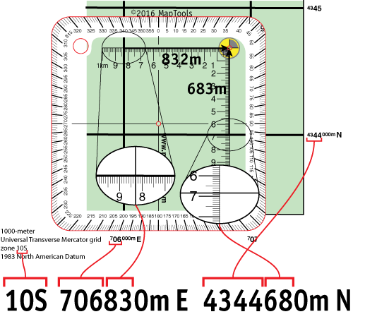
Four corner rulers on a single card covering the most common scales used for aerial photography. Each corner ruler allows you to plot a UTM coordinate within a 500m map grid with 10m precision. Each corner has a small hole to allow for placing a mark on the photo or map.
Add to Shopping Cart
Specifications
Scales:
- 1:5,000 x 500m
- 1:8,000 x 500m
- 1:12,000 x 500m
- 1:15,000 x 500m
Dimensions:
Height: 4.500 in. (114mm)
Width: 4.500 in. (114mm)
Thickness: 0.030 in. (1mm)
Made in US.
Related Products
How to use products like this...
Using a corner ruler roamer style tool to plot/measure a UTM position with 10m precision
Here is a tutorial on using this type of tool.
Here is information on using the Universal Transverse Mercator coordinates (UTM).
Here is information on using the United States National Grid (USNG).
Here is information on using the Military Grid Reference System (MGRS).